Saturday, 27 September 2014

Tenerife - The Paisaje Lunar or Lunar Landscape (Los Escurriales)

Our last walking route I had planned for us in Tenerife was to see the famous Paisaje Lunar or ‘Lunar Landscape’. I thought I have seen so many outlandish, strange landscapes around the Teide volcano that I couldn’t imagine what could be more lunar landscape-y! Well, seemed like I was in for a treat.

The route starts literally in the middle of nowhere. You have to drive a bit out of the small village of Vilaflor, situated on 1450m above sea level, on the TF-21 road. At about km 66, at the very end of a sharp turning point, you will notice a dirt road. It may or may not be closed. If you’re lucky and can drive through it will save you about 45 minutes of walking. Keep driving until you find a tiny lay-by and wooden sign posts uphill to the left.

Due to the highly eroding nature of the area it is not encouraged to walk amongst these slender shapes of white sand. They are environmentally protected in order to preserve them as long as it’s possible.

This is a very easy trail, suggested even for families. The 9km walk takes about 4 hours to complete (13km if you leave your car at the beginning of the dirt road). There’s only about 450m level difference on the whole walk.  

After a few minutes you will come to a T-junction where you have a choice to make. It is a circular route so you can do the walk in either direction. We turned left and followed the red-yellow-white coloured markings on the path edged with volcanic stones through the forest.


It was the perfect second day walk after climbing the Teide. We strolled under the bright green Canary pine trees (which can only be found on the Islands) breathing the fresh, clean air and enjoying the scenery around us. The mountains provided a perfect backdrop.


We finally arrived to the aim of our walk, the Lunar Landscape. From our vantage point we gazed down at the white turfs of pumice with wonder. This ‘moonscape’ was formed about 500 000 years ago when all the side products of the volcanic eruptions such as cinders, pumice and sediments fell in the ravine and got trapped in there. This thick layer all molded together while cooling down, just to be covered again with another layer of material which was harder and more resistant to erosion. Over hundreds of years the natural elements sculpted strange formations, similar to Los Roques de Garcia. What we had in front of us was unlike anything we’d ever seen. The Lunar Landscape seems like a striking contrast to the green forest and the blue sky.


Due to the highly eroding nature of the area it is not encouraged to walk amongst these slender shapes of white send. They are environmentally protected in order to preserve them as long as it’s possible.

This is a very easy trail, suggested even for families. The 9km walk takes about 4 hours to complete (13km if you leave your car at the beginning of the dirt road). There’s only about 450m level difference on the whole walk.
Enjoy. 

Friday, 26 September 2014

Tenerife - Sámara volcano

This cute little volcano is only a short drive away from the Parador de las Cañadas del Teide. Even though it´s relatively close to Teide it is completely different as its sides are smooth and its crater is an almost perfect circle. I´d never been on a crater before so I found the experience very special.


The walk up to its crater is very easy and only took about 15 minutes although there’s a well-marked walk of 2.5h if you feel up for it. I found the landscape very special as the whole area is covered with black volcanic sediment, cinders and lava rocks. The bright green of the pine trees scattered around the sides of Sámara looked very striking.


When you finally get to the top and look around the view will take your breath away. On one side we saw the sun slowly making its way down, giving long shadows over the pine trees and lighting up the top of the clouds. In the background the island of La Gomera looms thousands of feet below you.


On the other side we saw the other two volcanoes, Mount Teide and Pico Viejo. Standing on one and looking over another two mounds of rock and lava gives you the feeling of looking ‘behind the scenes’ of nature’s work. Priceless.


To get to the starting point just follow the TF-38, you will find it around the 8km mark.

Thursday, 25 September 2014

Tenerife - Climbing Mount Teide

As our second wedding anniversary was nearing I was looking for a suitable mountain to climb. Given that we’re living in Tenerife at the moment what other mountain could be better for the purpose than the highest point in Spain and Europe’s highest volcano, Mount Teide? On Friday afternoon we drove up to the Parador which is the closest hotel to the volcano therefore the perfect place to get used to the altitude. The drive is said to be spectacular as it leads you through Monte Esperanza however we didn’t see anything as it was all covered in a thick layer of cloud! We were seriously worried about our hike next day.


We needn’t have worried because as we drove higher and higher we gradually left the clouds behind. By the time we got there the cloud had disappeared and we did our first walk in the area around Los Roques de García.


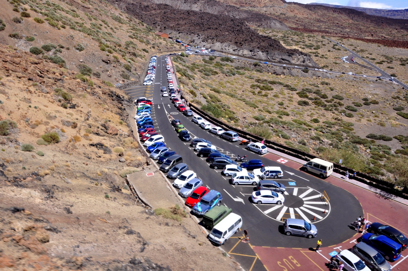
On Saturday morning we got up and drove to the start of the climb to Montaña Blanca which is not far from the Cable Car. What we didn´t realise was that there are only about 10 spaces in the car park! We got there by 9.30 and by then it was full. Luckily somebody was just leaving so we quickly got in.


We followed the Nr. 7 trail which seems to be the most popular route around. The first part was easy enough, we just followed the jeep track that gently ascended on the side  of the volcano. The views were spectacular around us.


We passed the ´Teide Eggs´. These huge lava rocks are volcanic ´balls´ that are slowly rolling down the side of the volcano.


Soon the gentle curves ended and we looked up with consternation at the next part of the climb. While we waited for the trail runners to get down (seemed extremely dangerous!) we prepared ourselves for the steep zigzag route that wound its way up. Couple that with the fact that thanks to the altitude you don´t get your usual amount of oxygen and suddenly the speed of the walk slows down significantly. We took quite a lot of breather stops.


This part ends at 3260m at the aptly named Refugio Altavista (High View) where we took shelter from the wind and had a few minutes break while munching on a cereal bar. It is possible to sleep over here but it is essential to reserve. It is managed by the same company as the Cable Car. Check out this website for the details, complete with a webcam of the crater.


From here our map showed us a suspiciously straight line. Yup, the route was straight. Straight up! It seriously felt like a trudge but with every step we were closer to the viewpoint. Luckily this part is quite short so soon we were having our lunch at the mirador on 3550m looking up at the last bit of the climb.


Unfortunately it is not possible to go all the way up to the crater for everybody, only 50 permits are released per day. We didn´t want to reserve it too far in advance in case the weather turns bad but it also meant that we missed our chance and couldn´t do the last bit. You can reserve yours here. Apparently you only need a permit from 9 in the morning so if you sleep in the Refugio you have a chance to make it up before.


After our lunch we slowly made our way to the cable car to buy our tickets. While we were waiting in the line we were amazed to see how many tourists come up here right from the beach wearing flip-flops and bikinis under their summer tops. People, you’re up at 3550m! It’s cold at this altitude!


While slowly riding the cable car down we looked around once more and vowed that we’ll be back, next time with a permit!


There are many websites and blogs dedicated to this route. I found this website quite good and detailed. It’s in Spanish but with the help of Google Translator I’m sure you can get the gist of it. 

Wednesday, 24 September 2014

Tenerife - Los Roques de García (Roque Cinchado)

As it was our second wedding anniversary we treated ourselves with a stay in a Parador hotel before climbing Mount Teide. Apart from the fact that it is the hotel at the highest altitude in the whole island and therefore staying a night here helps to acclimatise it has another advantage, there are Los Roques de García right in front of it! As soon as we checked in we went to explore these famous rocks.


Los Roques are a string of crazy, bizarre but seriously awesome volcanic rocks that stick out from the middle of the Ucanaca plain. Looking like they were shaped by a mad giant with some artistic talent they dominate the landscape. Walking around them made us feel very small, not only because of their sheer size but also because it made us think about the power of nature that can create a landscape like this.


The story of the Rocks takes us back to the time when the surrounding volcanoes were born. When the sides of two of these were pushed together a huge amount of material was pushed up from the depths of the Earth. As soon as this happened the water, the wind and the ice quickly started sculpting them with their erosive action. Thanks to these unique conditions a range of different rock types surfaced during different volcanic eruptions and were pushed together. These all have a different consistency therefore erode at a different speed.


The best example for this is right at the beginning of the trail at the Mirador de Roulette.  The famous rock called ´God´s finger´ stands seemingly defying gravity but it will eventually collapse on itself. So go and see it now while it´s still standing! Mount Teide provides a great background for the photo.


After you fight your way through the crowd of tourists who only come to take that certain photo you will soon find yourself alone in the shadow of the Roques. The trail No. 3 is a short and easy one with spectacular views at every step. It gradually descends down to the plain only going through about a 100m level difference however you will have to make this up on the last few meters of the walk. I would say give it about 1,5 – 2 hours to give yourself time for the ‘standing with my jaw dropped’ moments and to all the 325 photos you will likely take.    


Another ‘star’ of the Roques is the Cathedral which you will see toward the end of the route. This mini-mountain is a bit further away from the rest of its friends, not joined together like them, and sticks out of the plain demanding all the attention to itself.


The trail is well marked and easy to follow. Make sure you have plenty of water and sun cream as the sun can be harsh. If you need more info on this walk check out this website. If your Spanish is not up to this level use Google Translate to help you.