The
Sierra de Grazalema was the first natural park in Andalucia, now a UNESCO
Biosphere reserve. It is a highly protected, very special place. The area
offers spectacular landscapes full of rugged mountain peaks and gorges. Due to
its annual high amount of rainfall it has an amazing variety of plants, including
a special type of fir that is a ‘leftover’ from the prehistoric ages. It also
has an impressive black vulture colony.


The
area is so protected that you have to apply for a permission to walk on some of
its hiking routes (these can be obtained from the El Bosque Information
Office). In some crucial months of the year hiking is not even permitted.
Luckily we went late in the year and found a lovely route which took us up to
two peaks, to the Simacón and to the Reloj.

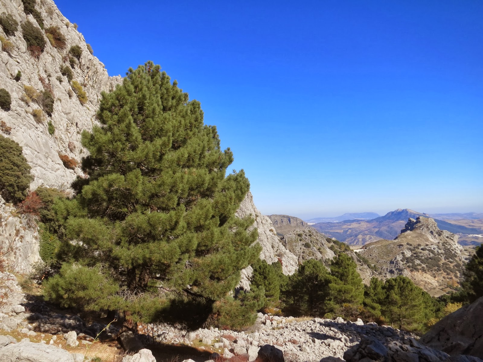
The
hike started with a nice ascent through a pine forest with huge pine trees. We quickly
gained height and had lunch in a lovely spot overlooking the valley.


As
we continued our walk we came across this heard of wild deer which seemed quite
tamed and did not run away even when we walked relatively close to them.


Then
we got to Simacón. The description of the hike did talk about scrambling but we
always take these warnings with a pinch of salt, we are in Andalucia, after
all. This time however it seemed to be true and we made our way up to the top.
The view was amazing, as always.


Curiously
we noticed that area was full of ladybirds! It seemed that there was a ladybird
party up there.


Then
came the hardest part of the hike. To be able to get from the peak of Simarcón
to the Reloj we had to go over a treacherous bit where the limestone was shaped
by the wind and the rain. It looked amazing but we really had to be careful
about where we put our feet. It was mentally exhausting to get through this
bit.


On
the top of Reloj. We could even spot Ronda from there!


The
route was only about 13km long but we found it very tiring due to the
difficulties between the two peaks.

This
area is the first one where the marking of the routes is seriously lacking.
Luckily we were up high so we were able to see where we have to go and our
smartphone map again proved to be useful. I would definitely advise taking a
map though as the different routes often criss-cross and it’s hard to find the
right one.
No comments:
Post a Comment